For most people, the story of drones is still told through specs: flight time, payload capacity, sensor resolution, or autonomy levels. But the real story, the one shaping the next decade of unmanned operations, is happening in the invisible spectrum.
It is a quiet, constant, and escalating war over signal dominance.
In every modern conflict, one truth keeps resurfacing:
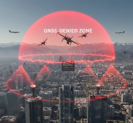
If a drone cannot operate in RF congestion or GNSS-denied environments, it is not relevant.
Not in real missions. Not in cross-border security. Not for emergency response. Not for defense.
And yet, most systems are still evaluated in isolated areas, stable RF, and open skies. The result: deployments fail, money is wasted, and national security teams discover limitations only after the drone is already in service.
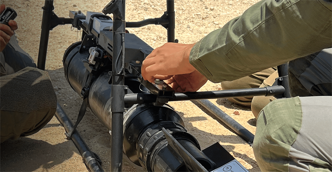
At UAX, our field teams have stress-tested 22 unmanned systems this year alone across complex terrains, RF-dense urban zones, dusty deserts, maritime edges, and contested spectrum environments. What emerges from these tests is clear:
The gaps aren’t in the hardware; they’re in the assumptions.
The New Battlespace: Why are the skies no longer Empty?
The modern RF spectrum is overcrowded.
Consumer electronics, industrial IoT, private 5G, Wi-Fi 6/7 networks, vehicle-to-everything (V2X), and municipal communication layers all compete for signal space.
Add electronic warfare (EW) tools to this mix, deliberate jamming, spoofing, and saturation and you get an environment where standard autonomy collapses. Let’s go into numbers…
Key Statistics
- In Ukraine, over 60% of drone losses are attributed not to kinetic fire, but to EW interference (Source: Royal United Services Institute, 2023).
- GNSS spoofing events worldwide increased over 25x between 2018–2024 (Source: C4ADS analysis of GNSS Interference Tracker).
- More than 70% of commercial drones depend on GNSS for positional stability and basic navigation (MITRE 2022 study).
In other words:
The sky is no longer a safe space, it’s a noisy, contested arena.
GNSS Denial: When the Ground Disappears Under the Drone
GNSS denial and spoofing are no longer exotic cyber tools used only by top militaries.
Today they are:
- Portable
- Cheap
- Highly effective
- Increasingly common near borders and sensitive facilities
In dozens of UAX tests conducted along GNSS-challenged zones (urban zones, mountainous ridges, high-latency coastal areas), we observed a recurring pattern:
Common Failure Modes in GNSS-Challenged Flight
- Position freeze drone stops updating coordinates but continues moving
- Spiral descent – triggered by faulty failsafe logic
- Return-to-home – drone attempts RTH to wrong coordinates
- Compass conflicts – IMU override causing drift or aggressive tilt
- Autonomy dropout – system falls back to manual control, which operators often cannot execute safely or understand quickly enough.
A quote from a senior NATO UAS program officer (2024) puts it bluntly:
“Most drones today are built for peace. But we deploy them in conflict.”
GNSS reliance is the single biggest structural weakness in unmanned systems and the industry knows it.
RF Congestion: The Slow, Silent Killer of Autonomy
Unlike deliberate jamming, congestion is not visible. It doesn’t trigger alarms. It just degrades performance – slowly, subtly, dangerously.
During an edge-environment test conducted by UAX in a coastal city center, a drone rated for 12 km range experienced control degradation at 1.7 km due to overlapping commercial 2.4 GHz networks and a construction site’s private 5G band.
No enemy jamming.
No malicious interference.
Just the modern world doing what it does every day.
Real Effects of RF Congestion
- Packet loss increases → autonomy models misread surroundings
- Telemetry drops → operator makes wrong decisions
- Failsafe triggers incorrectly → system aborts mission
- Video latency spikes → ISR becomes pointless
- Control link collapses → drone lost
A 2024 IEEE Sensors report found that latency above 120 ms dramatically reduces autonomous obstacle-avoidance reliability in small UAVs. Many consumer and “prosumer” drones exceed that threshold in congested zones without any alert to the operator.
Autonomy Under Fire: Why Algorithms Behave Differently at the Edge
Autonomous behavior is often tested in ideal locations:
- Open fields
- Far from cities
- Clean spectrum
- Clear skies
- No electromagnetic anomalies
This results in autonomy that works…
until it doesn’t.
When UAX performs autonomy validation, we intentionally place systems in:
- RF-saturated corridors
- Dust, heat, humidity
- Maritime reflections
- Vegetation occlusion
- GNSS – manipulated condition
The pattern is unmistakable:
Autonomy trained on sanitized data collapses under real conditions.
Why Autonomy Fails in the Field
- Sensor drift accelerates in RF noise
- IMU recalibration fails under vibration + temperature variance
- Lidar/vision systems degrade in dust, fog, low light, or sea glare
- Failsafe logic triggers too conservatively or too late
- Models trained on static datasets fail in dynamic situations
A UAX senior field engineer summarized it best during a desert test:
“Algorithms didn’t fail in the lab. It did when we took it to some real scenario practice .”
The Coming Shift: From GNSS-First to GNSS-Optional Architectures
The next generation of unmanned systems will and must transition to multi-input, GNSS-optional autonomy.
Industry leaders across NATO, DARPA, and major defense integrators are already prioritizing:
- Vision-based navigation (VIO / SLAM)
- Terrain-relative mapping
- Inertial-only dead reckoning
- Signals-of-opportunity navigation (LTE, Wi-Fi mapping)
- Magnetometer-independent heading
- AI fusion engines combining 8–12 sensors
DARPA’s ACE autonomous dogfight program demonstrated in 2023 that autonomy can outperform humans when it operates with redundant navigation channels.
But redundancy is only part of the solution.
What matters is validation.
At UAX, when we test a GNSS-optional autonomy system, we force it through denial, spoofing, and multipath interference. Only then can we see whether redundancy is real or theoretical.
What this means for Government Buyers & Critical Infrastructure
Government agencies, defense units, and critical infrastructure operators now face two realities:
Reality 1: GNSS-denied zones are the new normal.
Whether due to intentional EW or environmental factors, GNSS cannot be trusted as a sole navigation method.
Reality 2: Autonomy must be validated, not assumed.
Procurement frameworks still rely heavily on documentation, vendor claims, and sanitized demos.
Yet over 15 years and 33 countries of field work, a clear pattern emerges:
Systems fail not due to bad engineering, but due to unrealistic testing conditions.
The good news?
This is solvable, with proper technical diligence and field validation.
The UAX Method: Closing the Gap Between Spec Sheet and Reality
In a hybrid visibility style, here is where UAX appears naturally and credibly:
UAX combines engineering teardown, sensor-fusion analysis, and edge-environment field testing to evaluate unmanned systems under the same stresses they will face in operational use.
Our 7–14 day validation framework assesses:
- RF resilience
- GNSS-denial behavior
- Autonomy under drift or occlusion
- Environmental stress (heat, dust, vibration, maritime conditions)
- Payload integration impact
- Fail-safes under spectrum chaos
Governments use these findings to deploy smarter capital.
Investors use them to avoid funding systems that break at the edge.
Founders use them to fix critical failures early—before they scale.
Looking Ahead: The Future of Autonomous Systems in Contested Environments
The next decade will belong to unmanned systems that can:
- Operate without GNSS for extended periods
- Self-correct under RF interference
- Navigate densely built environments
- Adapt autonomously to sensor degradation
- Maintain mission value despite signal loss
The winners will be those whose autonomy is trained, tested, and hardened in the real world not the ideal one.
A UAX field report from mid-2024 concluded with a single line that captures the industry’s direction:
“The future of autonomy is not in better AI. It’s in better validation.”
Sources & References
- Royal United Services Institute (RUSI), “Drone Loss Statistics in Ukraine,” 2023
- C4ADS GNSS Interference Tracker Analysis, 2024
- MITRE Corporation, “Commercial Drone Navigation Reliance,” 2022
- IEEE Sensors Journal, “Latency Thresholds for Autonomous Obstacle Avoidance,” 2024
- DARPA ACE Program Overview, 2023